
SatTrackCam Leiden
satellite tracking camera station Leiden
Cospar stations 4353 / 4354
 |
SatTrackCam Leiden satellite tracking camera station Leiden Cospar stations 4353 / 4354 |
|
| Short outline of SatTrackCam Leiden | Targets | Web resources | Contact | Station (B)log - what's happened at the station the past weeks? | |
The
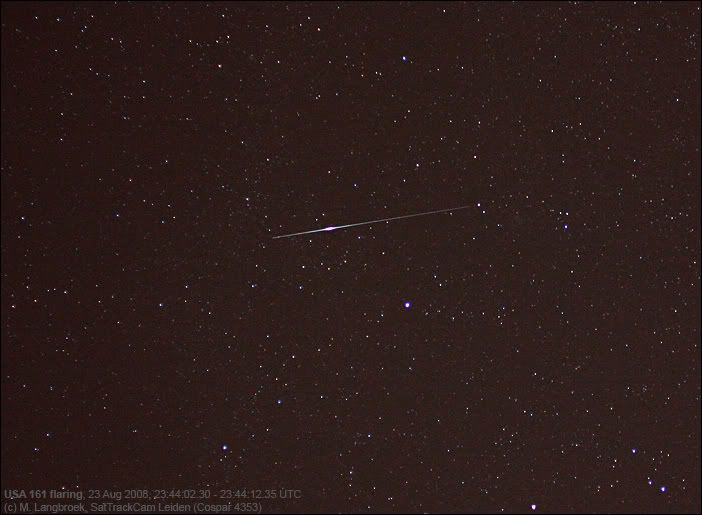
US spy satellite USA 161
(01-044A) was launched in 2001 and is a KH-12 Keyhole
class high resolution
optical imaging satellite. Here it is shown briefly flaring,
as one of it's reflective surfaces catches sunlight
| NOTE:
I am in the process of rewriting this 4-year-old page, in order to have
it better reflect the significant technical changes on my satellite
observing station over those years. So the content of this page will
change over time, and currently is a bit minimal. For many continuosly updated photographs and timely observing reports (with backgrounds on the objects observed), see however my observation (B)log here. |
SatTrackCam Station Leiden (Cospar 4353)
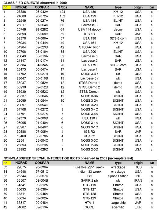
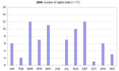
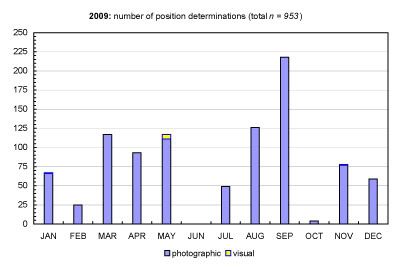
SatTrackCam Leiden is an amateur observational station in the center of Leiden town, the Netherlands, which employs photographic techniques to determine positions of classified satellites.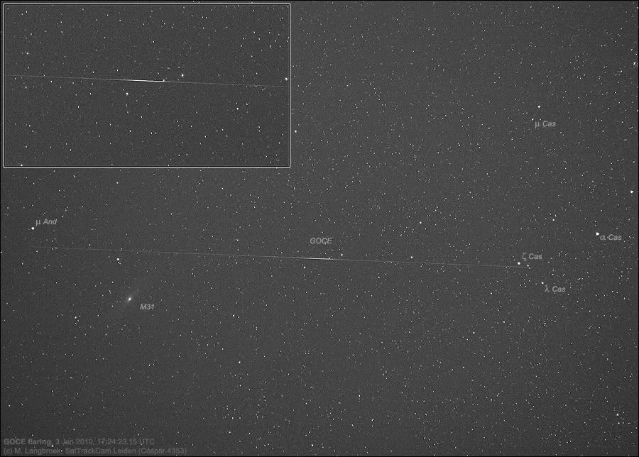
Why do I track these satellites?
Why do I track these satelllites? For the same reason why some people spot birds: because it is fun, and interesting! And that is the most important reason there is to it for me. It gives me something to do in the evening, data to play with, nice pictures to obtain. There is a certain challenge to it. And it is one of few astronomical activities suitable to do for me from my urban, light-polluted environment.
Some people ask me if tracking US military satellites isn't illegal. The answer is: no, not at all. Space is international territory and you are free to document what moves about there (indeed, the US Government publishes tracking data of foreign nation's spacecraft herself on her website Space-Track). In fact, standing UN treaties demand countries with a space program to make the orbits and locations of the spacecraft they launch public and register their spacecraft (United Nations resolution 2222 (XXI). Treaty on Principles Governing the Activities of States in the Exploration and Use of Outer Space, including the Moon and Other Celestial Bodies, article XI).
And frankly: it is a bit silly that the orbits of these military objects are "classified". The loose amateur tracking network in which I partake shows that it is very easy to obtain reasonably accurate orbital data for these militairy reconnaissance sats with very modest means. In a sense, we serve as a reality check to the military, pointing out that there are limits to realistic secrecy. They should not expect that nobody knows where their reconnaissance sats are.
Yet I won't complain, as the decision to keep them classified provides me with the fun activity of making positional measurements for amateur orbital determination. It is a challenge, and we trackers have taken up this challenge.
(Note: a good background article on amateur spysat-tracking appeared in the February 2006 issue of Wired Magazine,on-line here, with another nice article from the NY Times here)
Web
Resources:
Visual Satellite Observers' Homepage (recommended!)
Heavensat software by Alexander Lapshin for satellite pass predictions including plots of sky tracks
Quicksat
and other software by Mike McCants for satellite pass predictions and
brightness predictions
Mike McCant's satellite tracking TLE's page
Astrorecord
astrometric software plus nececessary
update & auxilliary files
by Marc de
Lignie, Dutch Meteor Society
Obsentry software download by George D Lewis to
easily convert data to
IOD format lines.
Obsreduce by Ted Molczan, for visual observations using a stopwatch.
Scott Campbell's software for satellite orbital determinations and data analysis
SeeSat Mailing List homepage
SSC Space-Track orbit catalogue (needs a login-account).
GlobalSecurity.org pages on
military space reconnaissance
The weather at Cospar 4353:
SatTrackCam Station Leiden is operated by Dr Marco Langbroek ( homepage )
First version published 02/08/2005
Last update: 04/01/2010
Content and photographs (c) 2005-2008 SatTrackCam/M. Langbroek; all rights reserved